In the winter of 2006/2007, Google Maps replaced the blurry 1998 photo of my land with a new one that showed much more detail. I made a map out of that, and then Google made a nicer looking image out of the same data, so in March 2010 I updated it with different notations. NH is north hill, WH is west hill, S is the spring, T is where I put the tent platform, and O is the main orchard, although I've planted stuff all over the bottomlands. Farther down, M is the dense reed canarygrass that I call the meadow, Sw is the swampy area, and P is the area I call the parking lot. Stuff I haven't done yet is not marked. The lowest elevation line is 2640 feet and the highest is 2800. The actual property lines are about 50 feet inside the edges of the image.
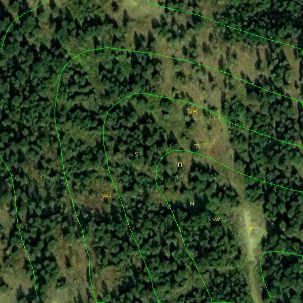
(This was made out of two images, saved via the Puppy Linux screen capture utility, and stitched together using layers in mtPaint, which I also used to pixel-paint the letters.)
(This was made out of two images, saved via the Puppy Linux screen capture utility, and stitched together using layers in mtPaint, which I also used to pixel-paint the letters.)